The Ministry of Disaster Management and Relief (MoDMR) was supported by the UN Office for Disaster Risk Reduction (UNDRR), the UN Resident Coordinator’s Office (UNRCO), and the Global Earthquake Model (GEM) Foundation to establish a sub-national earthquake hazard and risk assessment in Bangladesh.
A detailed, open sub-national earthquake risk model and evaluation of seismic risk for Bangladesh at the zila and upazila levels was developed. The risk model encompassed a probabilistic seismic hazard model, a building exposure model, and a seismic fragility and vulnerability model for Bangladesh's building stock. Additionally, it included critical scenarios for key cities based on the results of the probabilistic risk assessment in consultation with local stakeholders and experts.
This process was overseen by a panel led by the MoDMR and included representatives from the Ministry of Housing and Public Works, Bangladesh Bureau of Statistics, Geological Survey of Bangladesh, Bangladesh University of Engineering and Technology, and the University of Dhaka.
Different assessments with data inputs and outputs to understand and combine hazards, exposure, and vulnerability are documented in the Global Earthquake Model (GEM) Foundation project site. It includes:
Assessment | Inputs | Outputs |
| Population and Building Exposure | - 2011 Population and Housing Census
- Foundation for residential exposure
- Building materials used throughout the country
- 2013 Economic Census
- Foundation for commercial / industrial exposure
- 2014 Slum Areas and Floating Population Census for informal urban constructions to infer vulnerability based on dwelling unit types
- 2022 census at the district level
- Preliminary population counts
- Upazila-level data on building materials
| Exposure maps Exposure models |
| Infrastructure Exposure | - Residential, industrial, and commercial structures previously covered by GEM’s exposure models at the zila level (updated to the upazila level during this project)
- Healthcare and educational facilities in the country, including all hospitals and clinics, and all schools, colleges, and universities.
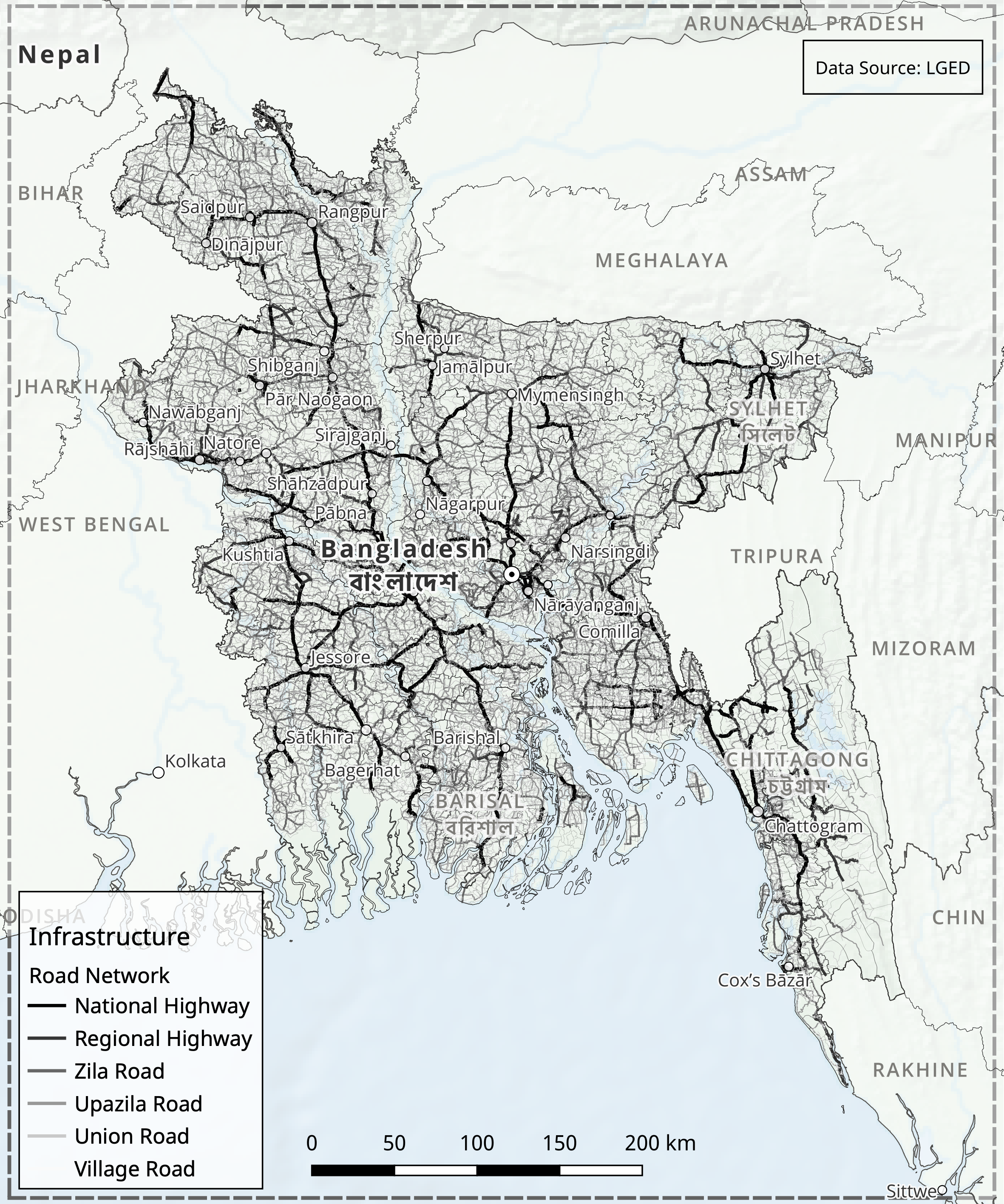
| Exposure road network map Seismic risk profile - infrastructure |
| Earthquake Scenarios | - Rupture geometries for events
- Range of ground motion models
- Potential damage and losses impact assessment
- Scenario set of 12 events – 7 historical events from 1664-1918, supplemented by five hypothetical events
| Scenario maps Earthquake scenarios |
| Probabilistic Seismic Hazard Assessment | Comprehensive seismic hazard model for Bangladesh that can be used for risk assessment and mitigation - Probabilistic seismic hazard model for the Indian subcontinent
- Updated and implemented for the OpenQuake engine
- Including seismogenic source models, ground motion models, and various tectonic regions
- Review of the seismic source model for northeast India and the improvements made to the model.
| Hazard maps Seismic hazard assessment |
| Liquefaction Hazard Assessment | Liquefaction susceptibility and hazard assessment - Regional liquefaction occurrence models which predict ground failure using existing mapped information and above-ground inferences of below-ground conditions.
- for the national scale liquefaction hazard assessment in the second phase of the project identifying the factors that contribute to liquefaction, the methods used for assessment, and the potential damage and losses that can result from liquefaction.
| Maps Charts Tables |
| Seismic Risk Assessment | The project estimated: - Seismic risk metrics estimation utilising the OpenQuake-engine's stochastic event-based risk assessment calculator
- Probabilistic seismic hazard analysis model to generate earthquake rupture forecasts and form a stochastic event set over a 100,000-year span
- Economic and human losses were computed for each event producing event loss tables and year loss tables
- Risk metrics included exceedance probability curves and average annualized losses
- Fatality and injury estimates relied on vulnerability models informed by global earthquake data, with a focus on South Asian building characteristics
- Results were tabulated nationally and regionally
- Exposure and risk of healthcare facilities, educational facilities, and the national road network to seismic hazards
| Risk maps averages Risk maps GRM averages Probabilistic seismic risk |
The outputs were validated during stakeholder consultations. Other outreach activities included communications and awareness raising, presentations to the Ministry of Disaster Management and Relief (MoDR), and different technical panels sessions. Training efforts included activities on site and online. Different reports capture the aspects and results of the project.
The project outputs support several preparedness and resilience aspects. This includes public awareness, empowerment of land-use planners and spatial planners, infrastructure strengthening and strategic investments, informed urban planning and sector-specific planning. It also supports earthquake preparedness beyond mitigation and improved civil-military coordination.